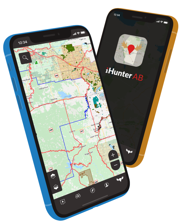
Alberta's #1 digital hunting companion.
Connecting you with the data you need wherever you want to go. In Alberta.


In-app purchases
Save yourself a trip while saving a few trees.
No more carrying around a stack of paper maps or traveling to different counties to purchase them. We've connected with regions all across Canada to provide landowner map layers right on your device.
iHunter AB lets you customize your map experience to be just as powerful as you need.

iHunterAB Pro subscription
$14.99 /year
Get an annual subscription to an additional set of provincial boundary layers covering special use areas so you're always up to date.
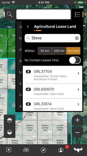
The Alberta Public Lands subscription includes 6 different map layers: Agricultural Lease Land, The Alberta Green Area, Vacant Disposition land, Huntable Public Parks, Restricted Access Land, and Registered Fur Management Areas.
Details


Landowner maps
$9.99 - $30.99
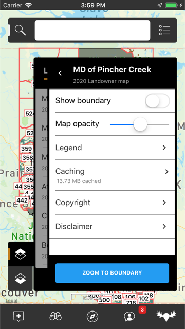
Over 60 county landowner maps available. Customize your map experience with additional boundary and landowner information for the zones you travel to most. Know where you are and who to contact for permissions to keep things safe and respectful.
Details

Features
Powerful tools at your fingertips.
iHunter AB has a host of location-based features to help you plan and stay informed on your journey. Pin important landmarks, overlay multiple boundary layers, and see the daylight or weather forecast for where you are or where you plan to go. Hunting season regulations are updated annually so you're always up to date. All from the palm of your hand.
Even more features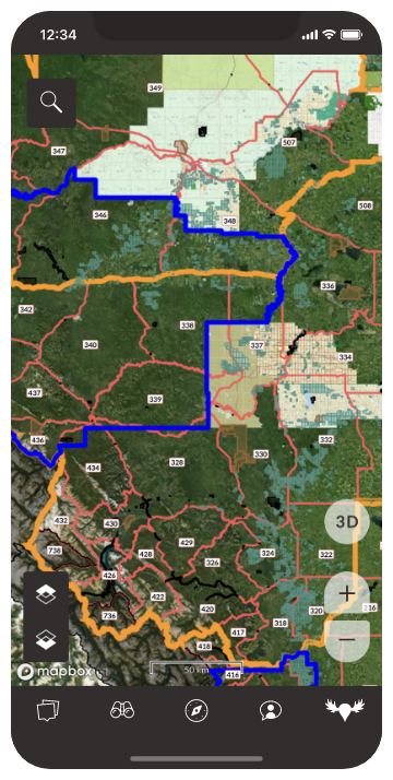
Map layers
Control your map experience using multiple colour-coded layers. Need even more? Customize it further with your own TMS and WMS data layers.
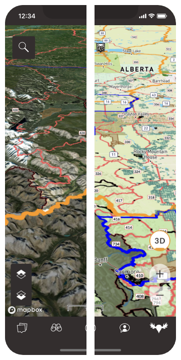
Base maps
Choose from a range of types including satellite, topo, and road maps. Switch to view in 3D. Link to additional tile servers to add even more options.
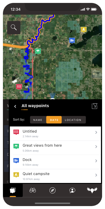
Waypoints
Add customizable markers at any location with icons, photos, descriptions, and weather information. Filter the map to show only the ones you want.
Tracking
Track your position and plot your route directly on the map, including duration, distance, and altitude information.
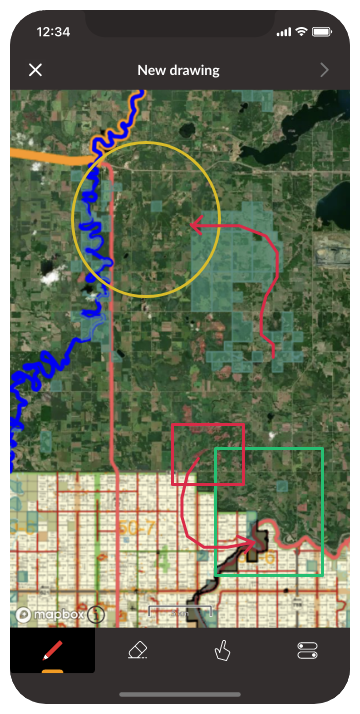
Drawing
Draw and measure on the map to plan your hunt or mark out important parcels of land and save them for reference.
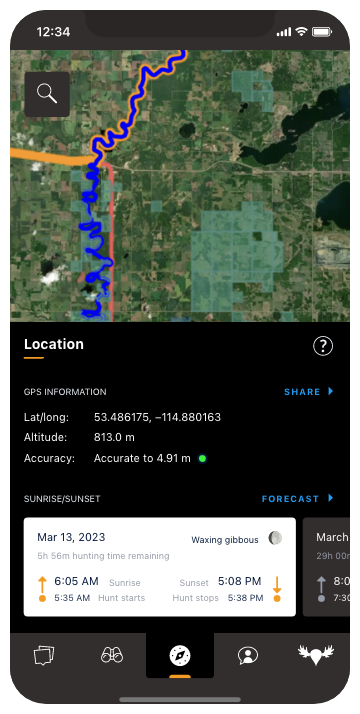
Sun calculator
Displays the sunrise/sunset times for today or for the future based on your specific location. No more complicated table lookups.

Map layers
Control your map experience using multiple colour-coded layers. Need even more? Customize it further with your own TMS and WMS data layers.
Base maps
Choose from a range of types including satellite, topo, hybrid, and road maps. Link to additional tile servers to add even more options.
Waypoints
Add customizable markers at any location with icons, photos, descriptions, and weather information. Filter the map to show only the ones you want.
Tracking
Track your position and plot your route directly on the map, including duration, distance, and altitude information.
Drawing
Draw and measure on the map to plan your hunt or mark out important parcels of land and save them for reference.
Sun calculator
Displays the sunrise/sunset times for today or for the future based on your specific location. No more complicated table lookups.
Map layers
Control your map experience using multiple colour-coded layers. Need even more? Customize it further with your own TMS and WMS data layers.
Base maps
Choose from a range of types including satellite, topo, hybrid, and road maps. Link to additional tile servers to add even more options.
Waypoints
Add customizable markers at any location with icons, photos, descriptions, and weather information. Filter the map to show only the ones you want.
Tracking
Track your position and plot your route directly on the map, including duration, distance, and altitude information.
Drawing
Draw and measure on the map to plan your hunt or mark out important parcels of land and save them for reference.

Sun calculator
Displays the sunrise/sunset times for today or for the future based on your specific location. No more complicated table lookups.
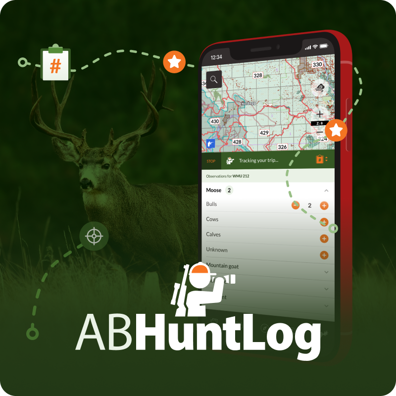
ABHuntLog
Input and impact in the palm of your hand.
Help conservation efforts in Alberta by contributing wildlife observations from the field, right within iHunter AB. ABHuntLog provides a handy dashboard with tallies of species you encounter by WMU, which you'll be thankful for when planning your next hunt. Submitting your observations can also help identify wildlife population trends throughout the province. Participation is optional and anonymous.
ABHuntLog was created in partnership with Alberta Conservation Association and Métis Nation of Alberta.
Learn more about it