Features

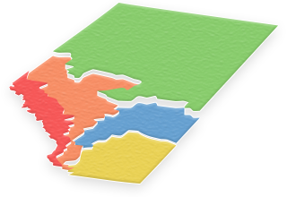
Wildlife hunting zones
iHunter puts the hunting boundaries right at your finger tips.
The zones are color-coded and placed over the built-in map service on your mobile device, so you can always tell exactly which zone you are in. Tap on the row for a hunting zone to get more detailed information about it and find links to the published regulations. You can also configure the map to only show the zones that are most important to you and hide the clutter.


Game seasons
For each hunting zone there is a detailed list of all game seasons.
It’s easier than ever to get details of the big game seasons for exactly where you are. iHunter also includes the season information for bears, cougars, and other predators, as well as all of the bag limits for game birds and small game.


Waypoints
iHunter makes it easy to customize the map for your own personal hunting experience. Add a waypoint at any location you want to easily add a title, description, photo, and current weather conditions. Location data can be added in any of the following ways:
- At your current location
- At the center of the map
- Input a specific Lat/Long
- Input GPS coordinates
You can use custom waypoints to remember important locations, store land owner contacts, photograph memorable kills, or anything else you want to make note of. And go back to edit or remove them at any time.

Sun calculator
iHunter has a built in sunrise/sunset calculator so there is no need to look up times in a complicated table.
Use the sunrise/sunset calculator to know how much hunting time is still available. The calculator will display the sunrise/sunset times and hunting start/stop times based on your specific time and location.

Weather and wind
Check the weather and wind information right in the iHunter app.
Weather data is available for any tapped location on the map as well as for your current location. No need to use multiple apps just to get location-specific weather and wind information.

Cacheable base maps
Choose from a number of base maps including road, topographic, hybrid, and satellite maps.
The base maps are displayed underneath all other boundaries and many of them are cacheable. This means that sections of the maps can be downloaded for offline use.


Sharing and chat
You can quickly send an email to your friends or loved ones letting them know your precise location. Put their minds at ease with lat/long coordinates and a handy link to Google Maps.
You can use the chat system to chat with your friends and family that also have iHunter. Create groups where you can share waypoints and locations or even broadcast your live location to each other.


Directions
Whether hiking through the forest or driving down the highway, directions to your favourite waypoints or tapped locations are available with the touch of a button.
Goto directions (a straight path from your location to your destination) are available within the iHunter app and driving directions are handled by the default navigation app on your phone.